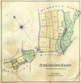
Surveys by John Whitcher
From The Muniment Room, a resource for social history, family history, and local history.
Revision as of 10:11, 23 August 2009; Admin (Talk | contribs)
(diff) ←Older revision | Current revision | Newer revision→ (diff)
(diff) ←Older revision | Current revision | Newer revision→ (diff)
John Whitcher, a land surveyor from Liphook in Hampshire[1], produced a series of surveys of the Fleming Estate as pocket books and large-scale folding plans, between 1816-1819. The pocket books contain estate maps and plans, with an accompanying terrier listing the lands and property.
[edit]
The Surveys
- Survey of Roger's Bargain and North Stoneham Poor House, 1816
- Survey of the Estates on the Isle of Wight, 1817
- Surveys of Stoneham, 1818
- Survey of the Estates at Romsey, 1819
[edit]
Selected images
[edit]
References and notes
- ↑ Other surveys by Whitcher for other estates include: 'A Map of Waldergrove Farm the property of Mr. Thos. Bridger' (1813), West Sussex Record Office Add Mss 9910; 'Survey of Lands the property of Thos Peckham Phipps Esq of Little Green, Sussex' (1818), West Sussex Record Office Add Mss 29,678; 'Plan of the boundary of Bohunt Manor adjoining the Forest from Cornford River to Liss Manor' (n.d.), National Archives F 17/390.


