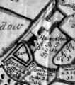
Map of the Manor of Chilworth, 1755
From The Muniment Room, a resource for social history, family history, and local history.
Revision as of 14:36, 8 April 2010; Admin (Talk | contribs)
(diff) ←Older revision | Current revision | Newer revision→ (diff)
(diff) ←Older revision | Current revision | Newer revision→ (diff)
Map of the Manor of Chilworth, 1755[1].
[edit]
Abstract/description
Map of the Manor of Chilworth in the County of Southampton belonging to Peter Serle Esq., 1755. Drawn by George Wilson; surveyed by William Grantham.
[edit]
Images
Detail showing Lords Wood |
Detail showing Chilworth village |
||
Detail showing Manor Farm and moat |
[edit]


